Osnovna ograničenja rada radara u vodenim sredinama
Slabljenje signala: Zašto radiovalovi slabo funkcioniraju ispod vode
Tradicionalno radar sistem podmorski uslovi zahtijevaju stroga ograničenja, s obzirom da se EM talasi slabiju u vodi. Radio-frekventna električna polja brzo se slabiju u vodi uslijed apsorpcije i rasipanja, a eksponencijalni gubitak signala nastaje zbog visoke električne provodljivosti morske vode. Najveće slabljenje javlja se u optičkom i UV opsegu, pri čemu ovi opsezi mogu prodrijeti samo na male dubine. Ovaj inherentni problem u istraživanju podvodne komunikacije ograničava funkcionalnost radara isključivo na plitke okruženja, što ga čini nepogodnim za upotrebu u dubokim vodama gdje dominiraju akustični pristupi.
Poređenje elektromagnetnog i akustičnog prostiranja
Dominantno ograničenje nastaje prilikom uspoređivanja ponašanja talasa: radio talasi izgube svoju snagu 1000 puta brže u slanoj vodi nego što to čine akustični signali. Možda uopšte nije bioo-mimika; umjesto toga, moguće je da se radi o izvoru sličnom sonaru i voda prenosi zvuk na hiljadama milja ispod površine vode, za razliku od radara iako je on 'kratkog dometa'. Imajte na umu da EM talasi radara brzo izgube snagu nakon nekoliko metara, dok sonar koristi zvuk niske frekvencije (preniske za ljudsko uho) koji se širi kroz okeanske bazene vrlo efikasno – voda ne zaustavlja niti usporava zvuk u velikoj mjeri, za razliku od elektromagnetnog zračenja. Ova razlika proizlazi iz osnovne fizike – provodljivost vode apsorbuje elektromagnetnu energiju dok pojačava širenje zvuka. Na ovaj način, čak ni najnaprednija radar tehnologija ne može konkurisati sonaru u pogledu efikasnosti dometa na dubinama koje nisu blizu površine.
Proboj u detekciji radara kroz površinske fenomene
Analiza valnih signatura generisanih na površini od strane podmornica
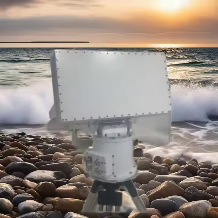
Zato napredne radar sistemi probijanje gubitka signala kroz vodu tako što se prate iste hidrodinamičke površinske smetnje. Pomjeranje vode kod podmornica dovodi do uočljivih površinskih efekata poput onih koje izazivaju Bernoullijevi bregovi i Kelvinov vuk (kelvinska struja). Nove studije pokazuju da radari milimetarskog vala mogu detektovati ove signale s visine od 8 km, te ih identifikovati kao umjetne uz pomoć analiza mašinskog učenja kojima se obrađuju visina talasa i uzorci interferencije (Daljinsko ispitivanje, 2025). Ova ne-akustična tehnika nudi važne informacije za praćenje kada sonar nije aktivan.
Tehnologija detekcije vuka pomoću Doppler radara
Podvodnički tragovi se otkrivaju korištenjem Doppler radar-a, koji iskorištava frekvencijske pomake ovisne o brzini. Ove nepravilnosti u šareni uzorak izazivaju karakteristične fluktuacije radarskog presjeka na više frekvencija. Savremeni algoritmi sada mogu otkriti signaturu tragova s tačnošću od 92% u stanju mora do 4, pri čemu se eliminiše smetnje od vjetrenih talasa i biološke aktivnosti. Učinjenost ove metode poboljšava se sa povećanjem brzine cilja, pa je posebno korisna za praćenje nuklearnih podmornica na dubinama manjim od 100 metara.
Studija slučaja: NATO-ina radarska ASW nadzorna ispitivanja
NATO 2023 North Atlantic ispitivanja također su testirala radar u ulozi borbe protiv podmornica koristeći mrežu radara visoke frekvencije za površinske valove. Vjerovatnoća detekcije od 72% postignuta je protiv dizel-električnih podmornica na udaljenostima od 12 km, uz postojeće mreže sonoboeva. Kombinacija sa satelitskim snimcima dovela je do smanjenja lažnih alarma za 40%, ali prepoznavanje položaja iz uzorka vijuge i dalje je teško kada se promatra veliki sisavac. Ove vježbe su demonstrirale korisnost radara kao popunjivača praznina u slojevitoj obrani tijekom tranzita u CONUS-u.
LIDAR Batimetrija: Inovacije u Kartiranju Dubina Obalne Zone
LIDAR batimetrija Korištenje zračnog impulsnog laserskog sistema u kombinaciji sa informacijama o pozicioniranju interferometra predstavljeno je kao nova generacija kako bi se prevazišla ograničenja sonara u plitkoj vodi. Koristeći zelene (532 nm) lasere koji mogu prodrijeti do 50 m dubine u čistoj vodi, ovi sistemi prikupljaju topografiju morskog dna s vertikalnom rezolucijom od 10-15 cm – tri puta boljom nego što je to jednobrani sonar. Trenutno, inženjeri za obalne objekte mogu koristiti sisteme za kartiranje dubina u priobalnom području kako bi identifikovali kretanje pješčanih grebena i lokacije erozije uz pomoć sistema za stvarno vrijeme koji se temelje na GNSS pozicijama ispravljenim radarom, čime se smanjuje greška kod uzimanja sedimentnih uzoraka za 60% (NOAA 2023). Nedavni redovni rad vodećeg proizvođača geoprostornih podataka dokaz je da se mjerenja izvode brzo, 8 km²/sat, kako bi se procijenilo stanje koralnih grebena i podvodni arheološki prostori.
Fuzija više senzora: Integracija radara sa hidroakustičkim podacima
Hibridni senzorski alati kombiniraju skeniranje površine milimetarskog radara s profilima multizraknog sonara da bi proizveli 3D modele podvodnih znamenitosti. Studija iz 2023. godine objavljena u časopisu Electronics od strane MDPI-a pokazala je da fuzija radarsko-hidroakustičnih signala poboljšava detekciju oštećenja podmorničkih cjevovoda s 72% (kada se koristi samo sonar) na 94% tačnosti, kroz uzajamnu povezanost uzoraka površinskog curjenja nafte i pukotina prepoznatih sonarom. AI model sistema uspostavlja korelaciju između metrike turbulencije radarskih valova i hidroakustičnih spektara, otkrivši 89% lažno pozitivnih rezultata nastalih zbog morskih organizama. Vojska je mogla obaviti operacije neutralizacije mina u priobalnim zonama čak 40% brže koristeći ovaj koncept dvostrukog senzorskog domena, dok je kašnjenje u fuziji podataka predstavljalo problem kod struja jačih od 4 čvora.
Vojne primjene ne-akustičnog detektiranja podmornica
Radarovo snimanje uzoraka podmorničke turbulencije
Aktivnost podmornice stvara buran tok ispod površine, koji se može otkriti kroz vidljive talase i anomalije u termalnoj strukturi. Ove karakteristike mogu biti primijećene pomoću tehnologije sintetičke aperturne radarske (SAR) interakcijom mikrotalasa sa površinom oceana. Temperature se razlikuju kada slojevi vode mijenjaju mjesto i kada postaje izraženija hrapavost površine, što omogućuje radaru da detektuje obrasce koji nisu vidljivi pomoću standardnih sonara. Ove karakteristike turbulencije označavaju važan napredak u ne-akustičnoj tehnologiji detekcije, pišu vojni istraživači, ali njihova efikasnost bi varirala u zavisnosti od dubine vode, stanja mora – i vidljivosti. SAR sistemi sada mogu prepoznati ove karakteristike tokom noći, u slučaju oblačnog vremena, uprkos optičkim ograničenjima.
Radar zasnovan na svemirskoj platformi za strategijsko pomorsko nadgledanje
Radar sistemi instalirani na satelitima omogućavaju dugoročno praćenje okeana preko granica jurisdikcije. Geostacionarni i nisko-orbitalni platformi opremljeni SAR instrumentima promatraju milione morskih milja dnevno i nastoje identifikovati vrtložne tragove i termalne gradijente koje podmornice ostavljaju na svom putu. Za razliku od akustičnih senzora, koji su ograničeni topografijom morskog dna, sistemi zasnovani na svemirskim platformama sposobni su lociranja poremećaja iz orbite, bez upozoravanja ciljeva. Ovakve raspodjele omogućavaju da se podaci šalju natrag u pomorska komandna centra već nakon 90 sekundi - efektivno skraćujući vrijeme reakcije. Ove mreže sa svemirskim konstelacijama osiguravaju 24/7 nadzor ključnih tačaka na moru, transformišući pri tome percepciju pomorskih prijetnji.
Analiza kontroverzi: Privatnost vs nacionalna sigurnost u nadzoru EEZ
Nerazorno radar monitoring je izazvao pitanja u vezi sa pravima nad Ekskluzivnom ekonomskom zonom (EEZ). Iako moreplovni zakon dozvoljava pomorske aktivnosti u stranim EEZ-ama, radar tehnologija može ispitivati obalne objekte osim vojnih objekata. Države obale tvrde da su takve mjere protiv člana 88. UNCLOS-a koji se odnosi na mirne aktivnosti u EEZ-ama, posebno kada uključuju praćenje istraživanja prirodnih resursa. S druge strane, mornarice argumentiraju da budući bojišta ostaju visoko more, detekcija podmornica u spornim vodama bi ometala podvodne sabotaže. Pravni stručnjaci navode sve veće razlike između "istraživanja mora" i "vojnog izviđanja", a 47% zemalja izaziva način praćenja u diplomatskim razmjenama. Stoga okvir za balansiranje treba riješiti potrebu za kontrolom obalne linije i zahtjevima zaštite nacionalne sigurnosti.
Komercijalni potencijali podvodnih radar tehnologija
Rješenja za inspekciju podvodnih cjevovoda u plitkoj vodi
Podmorski radar prvi put omogućava direktno praćenje cjevovoda u priobalnoj zoni (do dubine od 50 m), gdje su prethodni sonarni uređaji imali premalu razlučivost za ovu svrhu. Operateri neinvazivno utvrđuju stanje ukopavanja cjevovoda kroz inspekciju i interpretaciju refleksija radio talasa na promjenama gustine sedimenta i toplim tačkama korozije. Pomjeranje nivoa u milimetarskom opsegu kao posljedica erozije ili seizmičkih pomaka je upozorenje koje možete sebi priuštiti kako bi se spriječila ekološka katastrofa, a visokorezolucioni elektromagnetni profili su način da dođete do tog podatka. Takođe, automatske obavijesti o anomalijama omogućavaju intervenciju na moru po potrebi, čime se operativni troškovi smanjuju čak 40% u poređenju sa inspekcijom ronilaca. Ova tehnologija omogućava održivu energetsku infrastrukturu uz minimalnu nelagodnost za moredno dno u predjelima povučenih bušaćih platformi i aktivnim kablovskim koridorima.
Ultra-širokopojasni radar za marinu arheologiju
Otopljavanje tla i smanjenje površine reakcije poboljšavaju uslove za migraciju unutar sloja trodimenzionalnog kamenog nasipa sa ultra-tankim plimnim područjem. Naboji proizvode elektromagnetne impulse niskih frekvencija koji mogu detektovati metalne predmete, koncentracije keramike i drvene strukture zakopane u zemlji sa tačnošću od 15 cm, čak i na morskom dnu bogatom muljem. Dalje kampanje u Mediteranu tokom 2023. godine identifikovale su polja fenicijskih amfora koristeći obradu multisektralnih podataka, uz istovremeno očuvanje antropogenog pejzaža. Skeniranje u centimetarskoj razmeri umjesto destruktivnih radova iskopavanja omogućava digitalnu arhivu krhkog ostatka brodoloma. UWB sistemi povećavaju brzinu kartiranja lokacija tri puta u mutnim uslovima gdje nije moguće obaviti optičko skeniranje.
Često se postavljaju pitanja
Zašto se radijski sistemi muče pod vodom?
Radijski sistemi imaju poteškoća pod vodom zbog slabljenja signala izazvanog visokom električnom provodljivošću morske vode, koja apsorbuje i rasipa elektromagnetne talase vrlo brzo.
Kako nadogradjeni radar sistemi kompenziraju gubitak signala ispod vode?
Nadogradjeni radar sistemi bilježe hidrodinamičke površinske poremećaje izazvane podmornicama, koristeći tehnike poput milimetarskog valnog radara i Doppler radara za otkrivanje uzoraka i signatura bez upotrebe akustičnih metoda.
Koji su napredci postignuti u detekciji podmornica pomoću radara?
Napredak uključuje upotrebu radara za detekciju brazde na vodi, poboljšane algoritme za tačno otkrivanje i integraciju sa satelitskim snimcima radi smanjenja lažnih alarma. Osim toga, radar sistemi zasnovani na svemirskim platformama omogućavaju široka moguća praćenja.
Postoje li komercijalne primjene za tehnologiju podvodnog radara?
Da, tehnologija podvodnog radara ima komercijalnu primjenu kao što je inspekcija cjevovoda u plitkoj vodi, gdje nudi preciznost do milimetra, i marinu arheologiju, gdje se poboljšava otkrivanje artefakata i kartiranje lokaliteta.
Sadržaj
- Osnovna ograničenja rada radara u vodenim sredinama
-
Proboj u detekciji radara kroz površinske fenomene
- Analiza valnih signatura generisanih na površini od strane podmornica
- Tehnologija detekcije vuka pomoću Doppler radara
- Studija slučaja: NATO-ina radarska ASW nadzorna ispitivanja
- LIDAR Batimetrija: Inovacije u Kartiranju Dubina Obalne Zone
- Fuzija više senzora: Integracija radara sa hidroakustičkim podacima
- Vojne primjene ne-akustičnog detektiranja podmornica
- Komercijalni potencijali podvodnih radar tehnologija
- Često se postavljaju pitanja